


TRAIL MAPS
Digital maps are the primary guiding resource for the Walking City Trails. The entire network is featured on our Google Map, and we also offer individual trail maps on AllTrails, as well as GPX trail map files that you can download for use on other apps. (See the links below to access these interactive trail maps.)
What Google Maps offers in ease of use it can lack in specificity. Not all of the trail junctions in parks will appear on Google Maps. And since the Boston Boundless Trail traverses some rather big green spaces, such as the Blue Hills Reservaation, we strongly recommend pairing the Google Map with our written turn by turn directions (also available below) to avoid getting lost!

Boston Boundless Trail - Full Trail (AllTrails Map)
Boston Boundless Trail - Section 1 (AllTrails Map)
Boston Boundless Trail - Section 2 (AllTrails Map)
Boston Boundless Trail - Section 3 (AllTrails Map)
Boston Boundless Trail - Section 4 (AllTrails Map)
Boston Boundless Trail - Section 5 (AllTrails Map)
Boston Boundless Trail - Section 6 (AllTrails Map)
Boston Boundless Trail - Section 7 (AllTrails Map)
Boston Boundless Trail - Section 8 (AllTrails Map)
Boston Boundless Trail - Section 9 (AllTrails Map)
Boston Boundless Trail - Section 10 (AllTrails Map)
Boston Boundless Trail - Section 11 (AllTrails Map)
Boston Boundless Trail - Section 12 (AllTrails Map)
Click here to download a GPX file of the full Boston Boundless Trail map for use with other GPS apps.
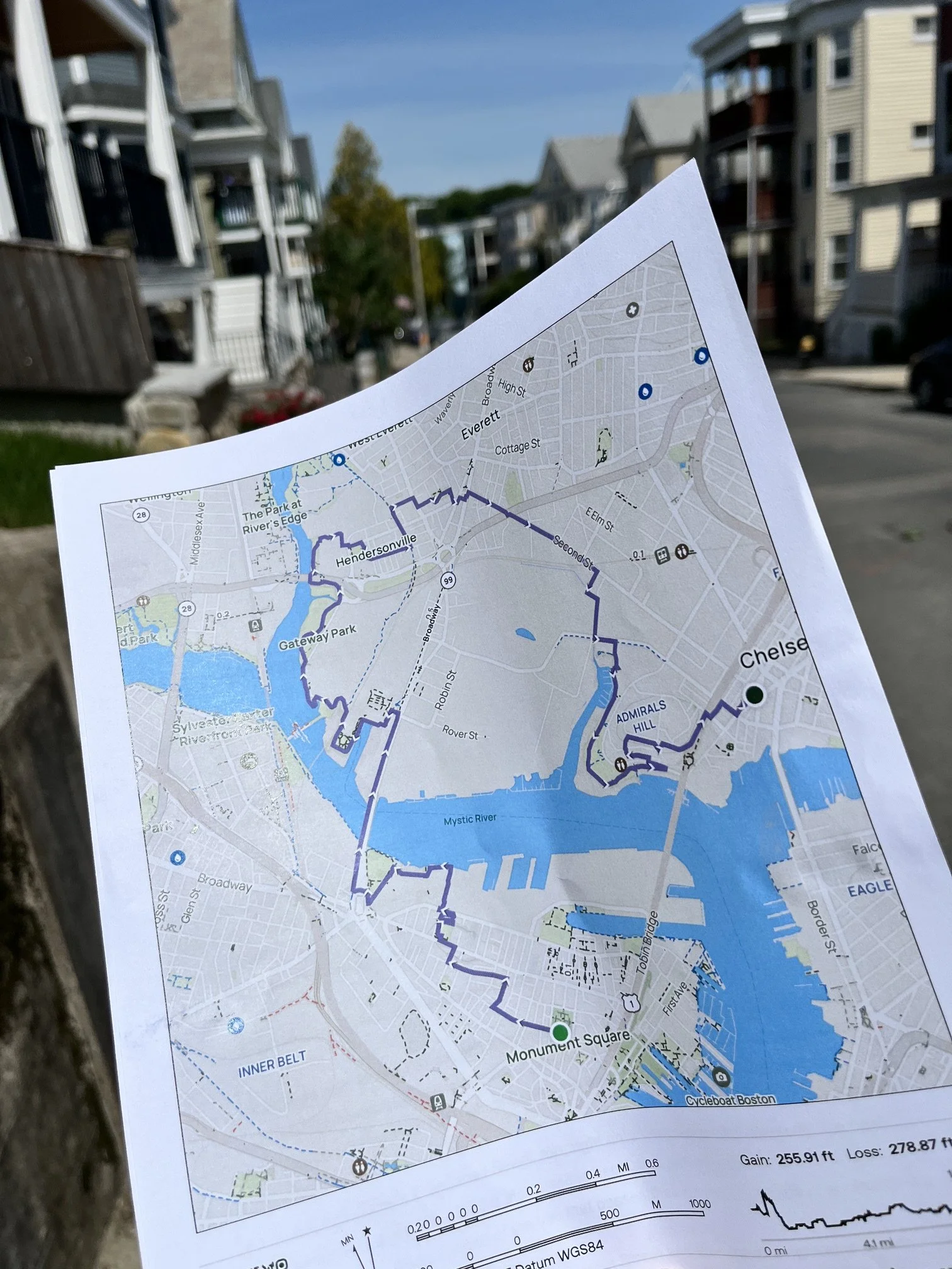
You can also download and print these section maps of the Boston Boundless Trail. Each map is 3-4 pages long.
Boston Boundless Trail - Section 1 (Printable Map)
Boston Boundless Trail - Section 2 (Printable Map)
Boston Boundless Trail - Section 3 (Printable Map)
Boston Boundless Trail - Section 4 (Printable Map)
Boston Boundless Trail - Section 5 (Printable Map)
Boston Boundless Trail - Section 6 (Printable Map)
Boston Boundless Trail - Section 7 (Printable Map)
Boston Boundless Trail - Section 8 (Printable Map)
Boston Boundless Trail - Section 9 (Printable Map)
Boston Boundless Trail - Section 10 (Printable Map)
Boston Boundless Trail - Section 11 (Printable Map)
Boston Boundless Trail - Section 12 (Printable Map)
TRAIL DIRECTIONS
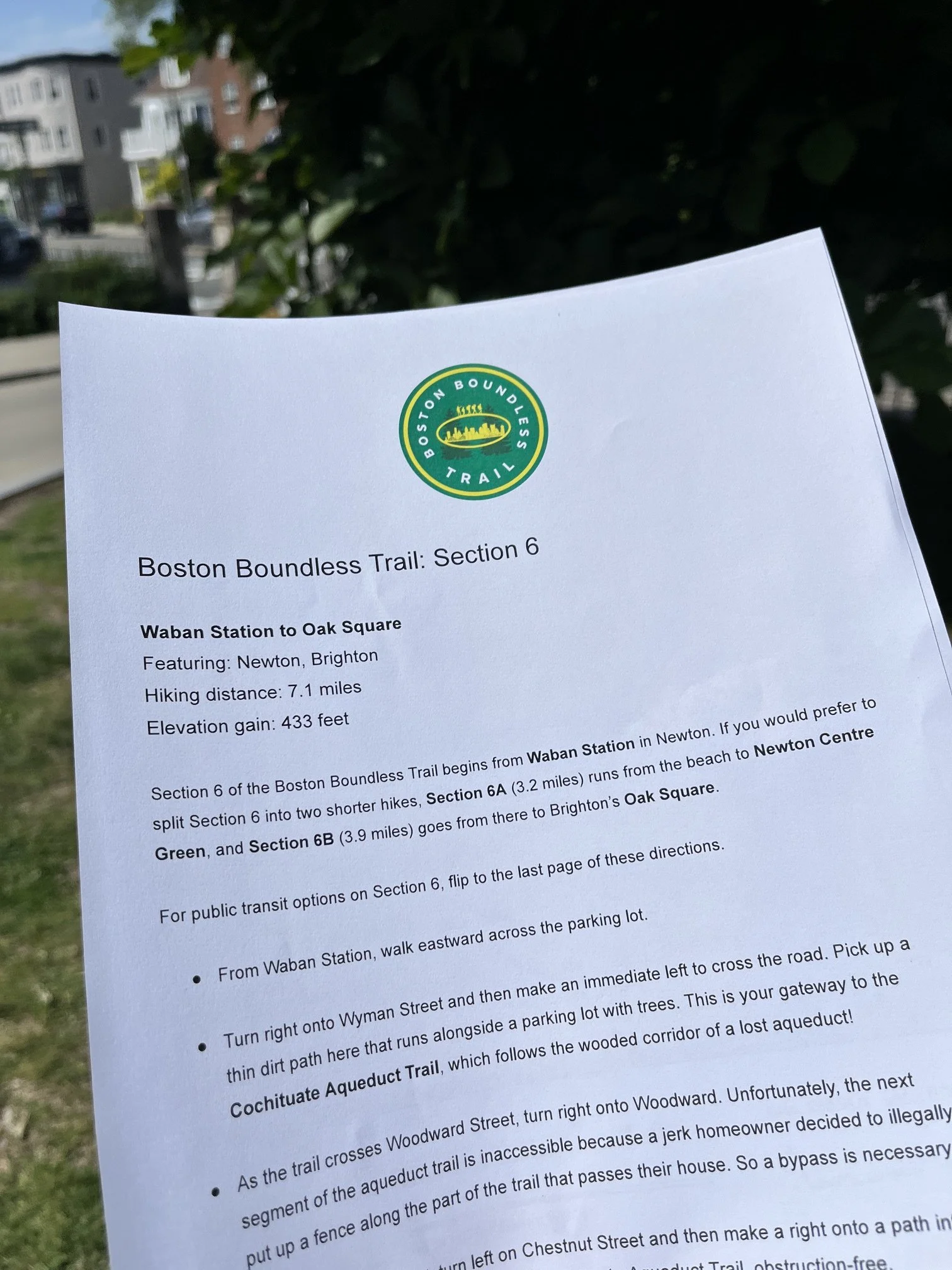
We’ve created turn-by-turn directions for the entire Boston Boundless Trail, and each trail section guide also includes information about public transit and food opportunities.
Boston Boundless Trail - Section 1 Directions
Boston Boundless Trail - Section 2 Directions
Boston Boundless Trail - Section 3 Directions
Boston Boundless Trail - Section 4 Directions
Boston Boundless Trail - Section 5 Directions
Boston Boundless Trail - Section 6 Directions
Boston Boundless Trail - Section 7 Directions
Boston Boundless Trail - Section 8 Directions
Boston Boundless Trail - Section 9 Directions
Boston Boundless Trail - Section 10 Directions
Boston Boundless Trail - Section 11 Directions
Boston Boundless Trail - Section 12 Directions