


WALK 149 MILES OF BOSTON PARKS, GARDENS, FORESTS, WETLANDS, AND STREETS
Connecting 175+ green spaces in and around Boston, the Walking City Trails network is a gateway to urban hiking across some of Boston’s most immersive parks, community gardens, “urban wild” zones, beaches, and neighborhoods. It was founded in the spring of 2022 by Bostonians with a shared passion for wandering.
The network began with the launch of the Walking City Trail; a 27-mile constellation of leafy paths, colorful streets, and hidden oddities like staircases and tunnels, running from the Neponset River in Mattapan to the Bunker Hill Monument. Three years later, a second cross-city trail was born—the City On The Hills Trail, which stretches 31 miles from Millennium Park in West Roxbury to Castle Island. Both trails are accessible by MBTA buses or trains, and they also offer access to local businesses.
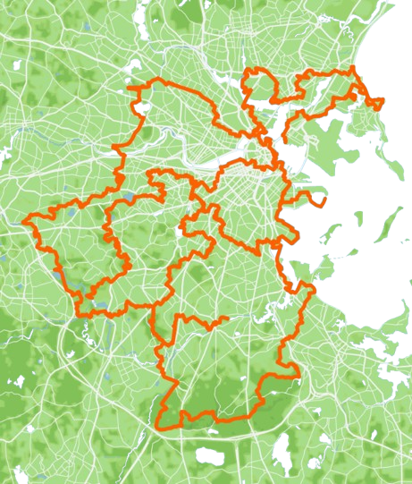
The latest addition to the network, the 91-mile Boston Boundless Trail, passes through every city and town surrounding Boston!

27.4 MILES
30+ GREEN SPACES
MATTAPAN, HYDE PARK, ROSLINDALE, JAMAICA PLAIN, MISSION HILL, FENWAY-KENMORE, BACK BAY, DOWNTOWN, CHINATOWN, LEATHER DISTRICT, WHARF DISTRICT, NORTH END, WEST END, CHARLESTOWN

31.1 MILES
40+ GREEN SPACES
WEST ROXBURY, CHESTNUT HILL, BRIGHTON, BROOKLINE, ALLSTON, MISSION HILL, ROXBURY, DORCHESTER, SOUTH BOSTON
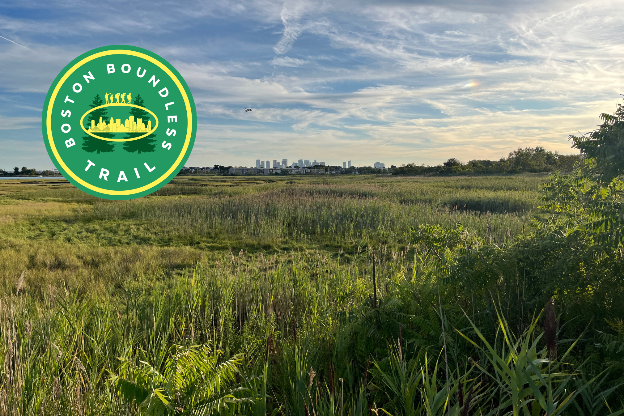
90.9 MILES
100+ GREEN SPACES
BOSTON, QUINCY, MILTON, CANTON, DEDHAM, NEEDHAM, NEWTON, WATERTOWN, CAMBRIDGE, SOMERVILLE, EVERETT, REVERE, WINTHROP . . . AND BOSTON
The Walking City Trails are yours to “activate” as you see fit! Explore them in pieces, walk an entire trail in one weekend, and recruit friends or family for your adventures. What better way to discover the full color of the cityscape than by hiking across Boston, where Frederick Law Olmsted brought the natural world to the city with the Emerald Necklace linear park system? Or where thousands of people walk the Freedom Trail, the Black and Women’s Heritage Trails, and the Boston Harborwalk each year? There’s a reason why Outside called the City of Boston one of America’s top hiking destinations in 2023.
Slip on your favorite shoes for poking around, grab some coffee from the nearest corner store, and use the maps and turn-by-turn directions from this website to experience the Walking City Trails today!

