
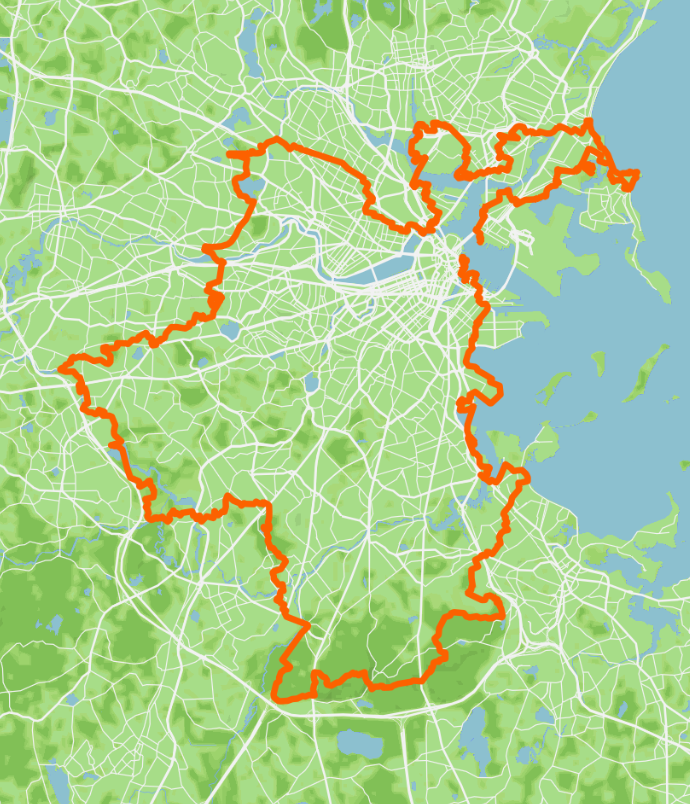
THE BOSTON BOUNDLESS TRAIL
Circling Boston for 90.9 MILES, starting and finishing on the harbor, the Boston Boundless Trail is an epic showcase of the Greater Boston Area’s natural and built beauty. It features 100+ green spaces and connects the City of Boston with every neighboring city and town. Scouting began in the summer of 2024, piece by piece, before the concept took off in the fall of 2025, when the Walking City Trails creators envisioned a mighty new urban hiking trail that would run through Boston and then, around it.
The Boston Boundless Trail is split into 12 sections that range from 4.7 to 11.1 miles. You can also divide each of the trail sections into two shorter hikes. All the Boston Boundless Trail segments are directly reachable by public transportation at numerous points and they include access to small businesses and a mix of public restrooms. You can walk the Boston Boundless Trail in incremental pieces or “thru-hike” the whole thing in one circular push!
SECTION 1. COLUMBUS WATERFRONT PARK, BOSTON HARBORWALK, FAN PIER PARK, NO MAN’S LAND, DORCHESTER HEIGHTS MONUMENT, CARSON BEACH, OLD HARBOR PICNIC AREA, SAVIN HILL (7.8 MILES)
Set off from Long Wharf North, next to Columbus Waterfront Park, and follow the Boston Harborwalk along the harbor through the Seaport and South Boston to reach the heights and the sands of Dorchester Bay. Here, after encircling the bay along a peninsula where UMASS Boston and the JFK Library are located, climb to a final lookout on top of Savin Hill before descending to Savin Hill Beach for a nice, briny finish serenaded by the local seagulls.
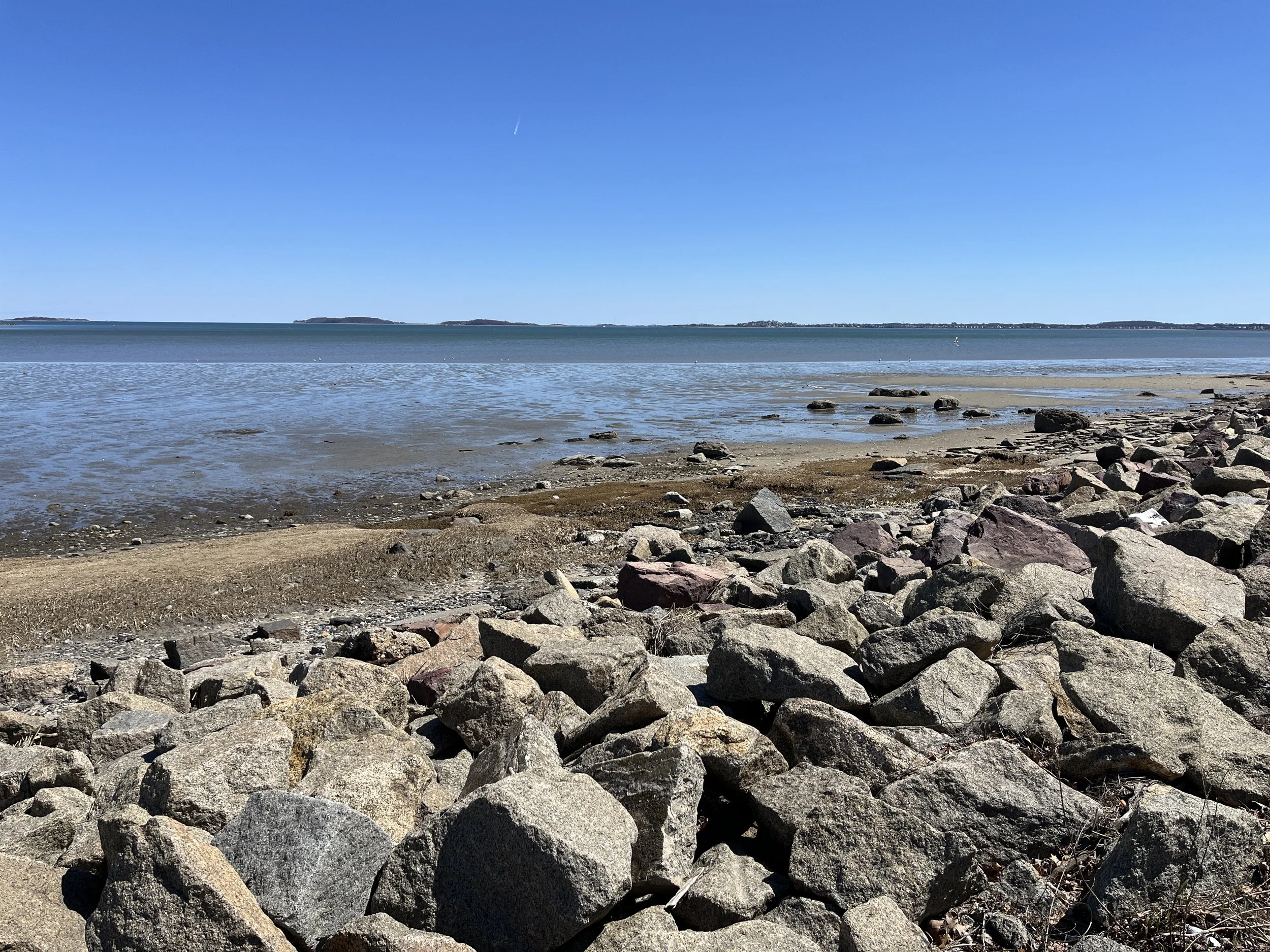
SECTION 2. SAVIN HILL BEACH, VICTORY PARK, TENEAN BEACH, NEPONSET RIVER RESERVATION, QUINCY RIVER WALK, BILLINGS SALT MARSH, WOLLASTON BEACH, CRANE PARK (7.8 MILES)
Follow the bends of the Boston Harbor shoreline to hidden nooks like Victory Park and Tenean Beach before crossing high above the mighty Neponset River into Quincy, where you’ll visit the expansive realms of Billings Salt Marsh and Wollaston Beach before pivoting westward into more residential territory in Quincy and then East Milton. Even here, as you begin your approach to the towering Blue Hills Reservation, rustling surprises abound.
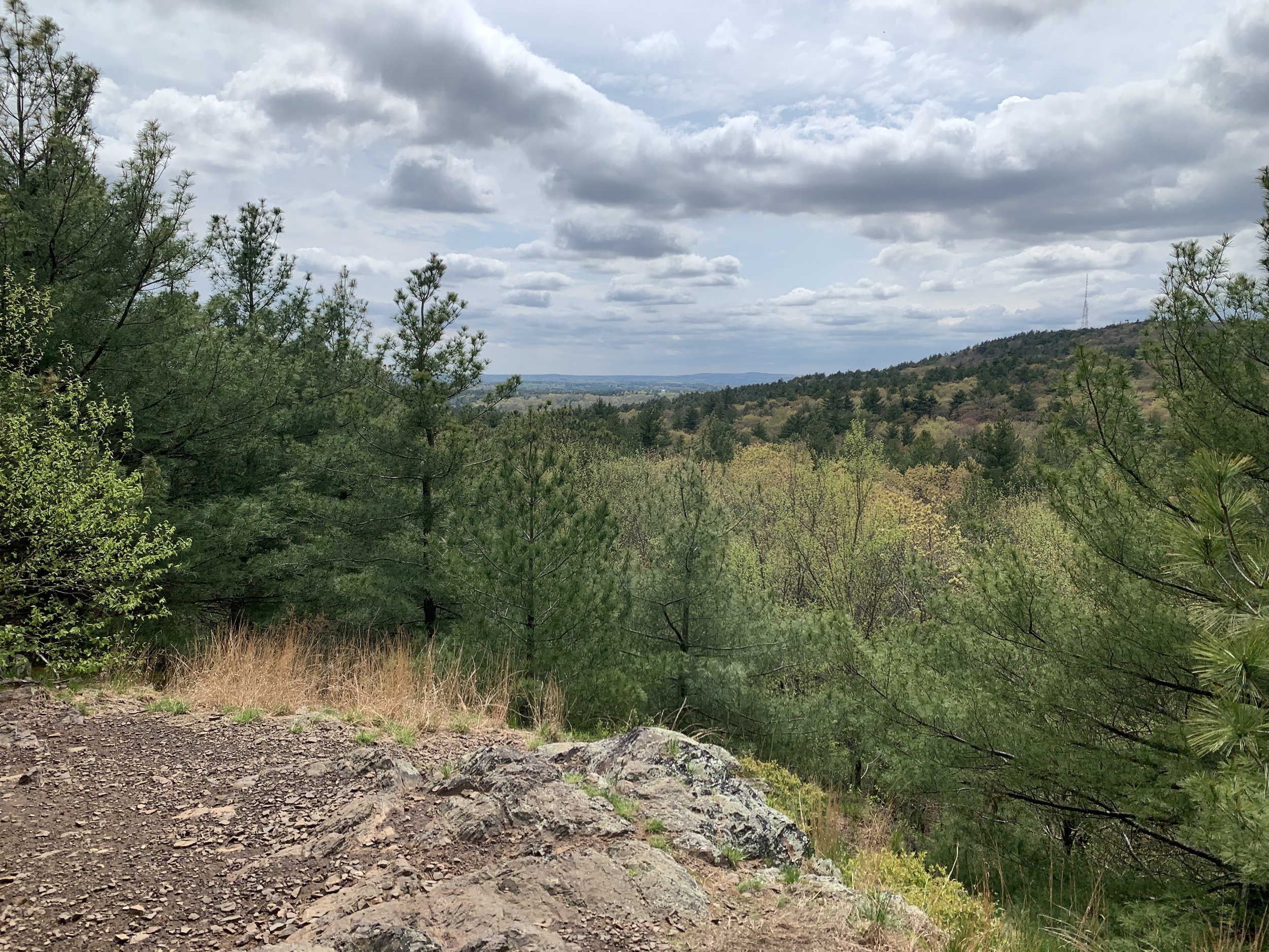
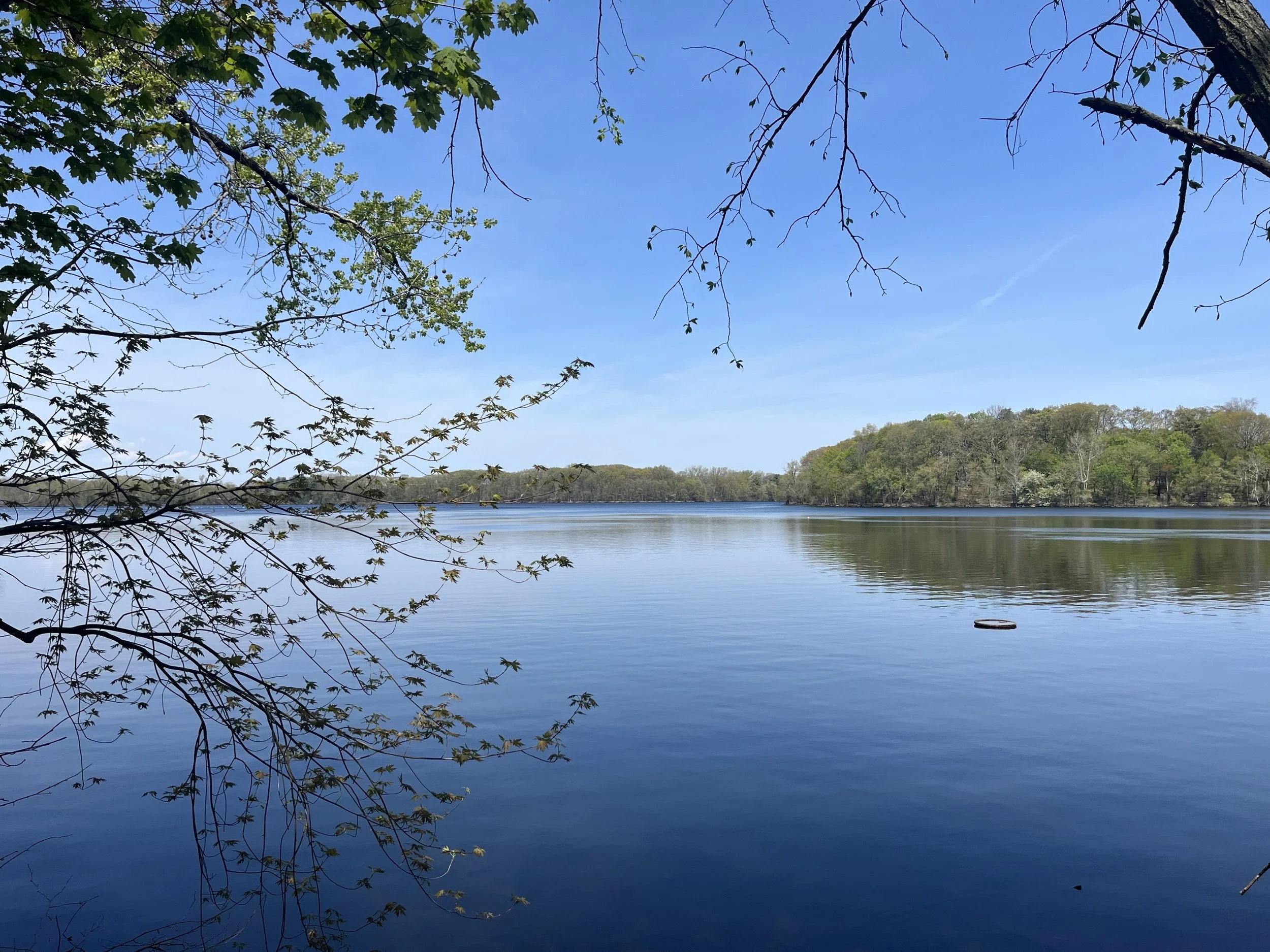
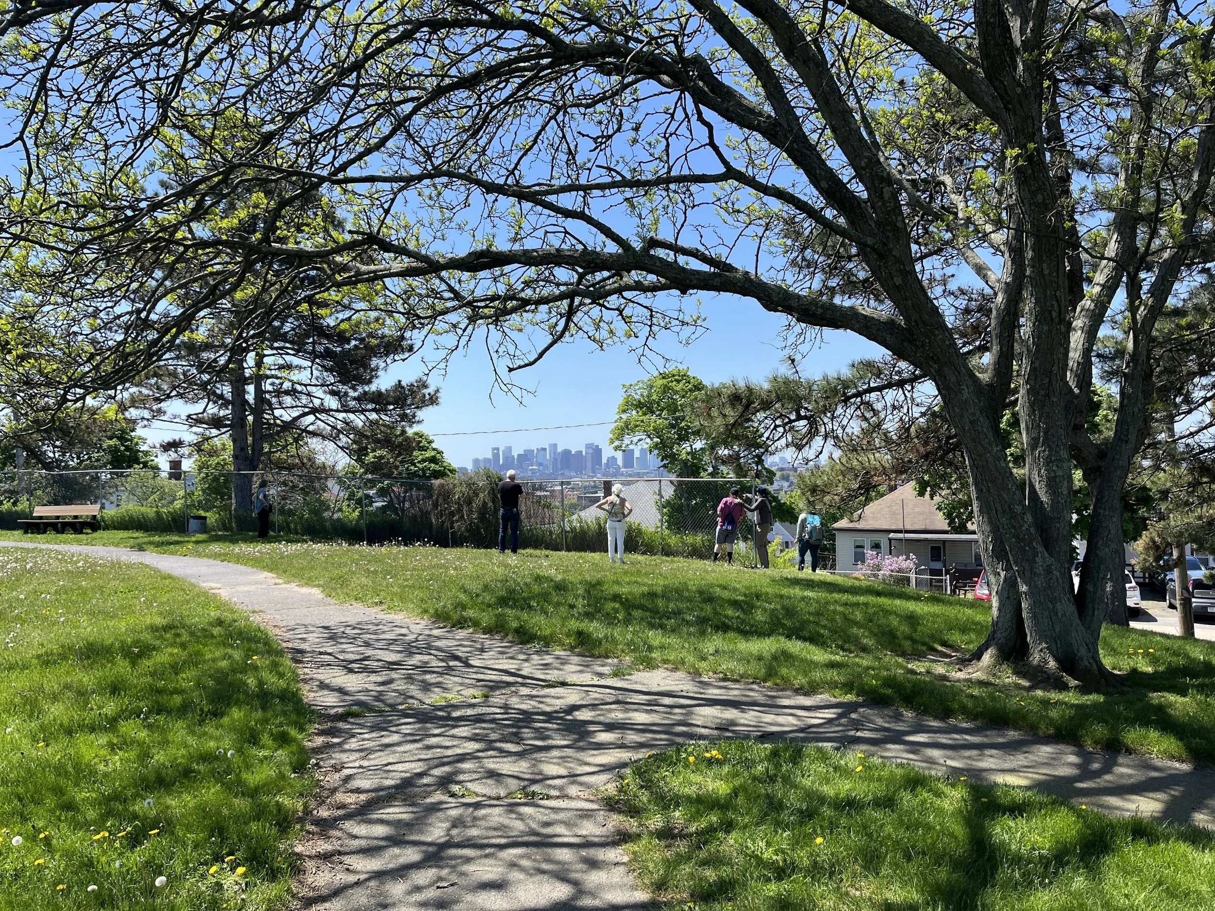
SECTION 3. CUNNINGHAM PARK, QUINCY QUARRIES RESERVATIOn, BLUE HILLS RESERVATION (9.7 MILES)
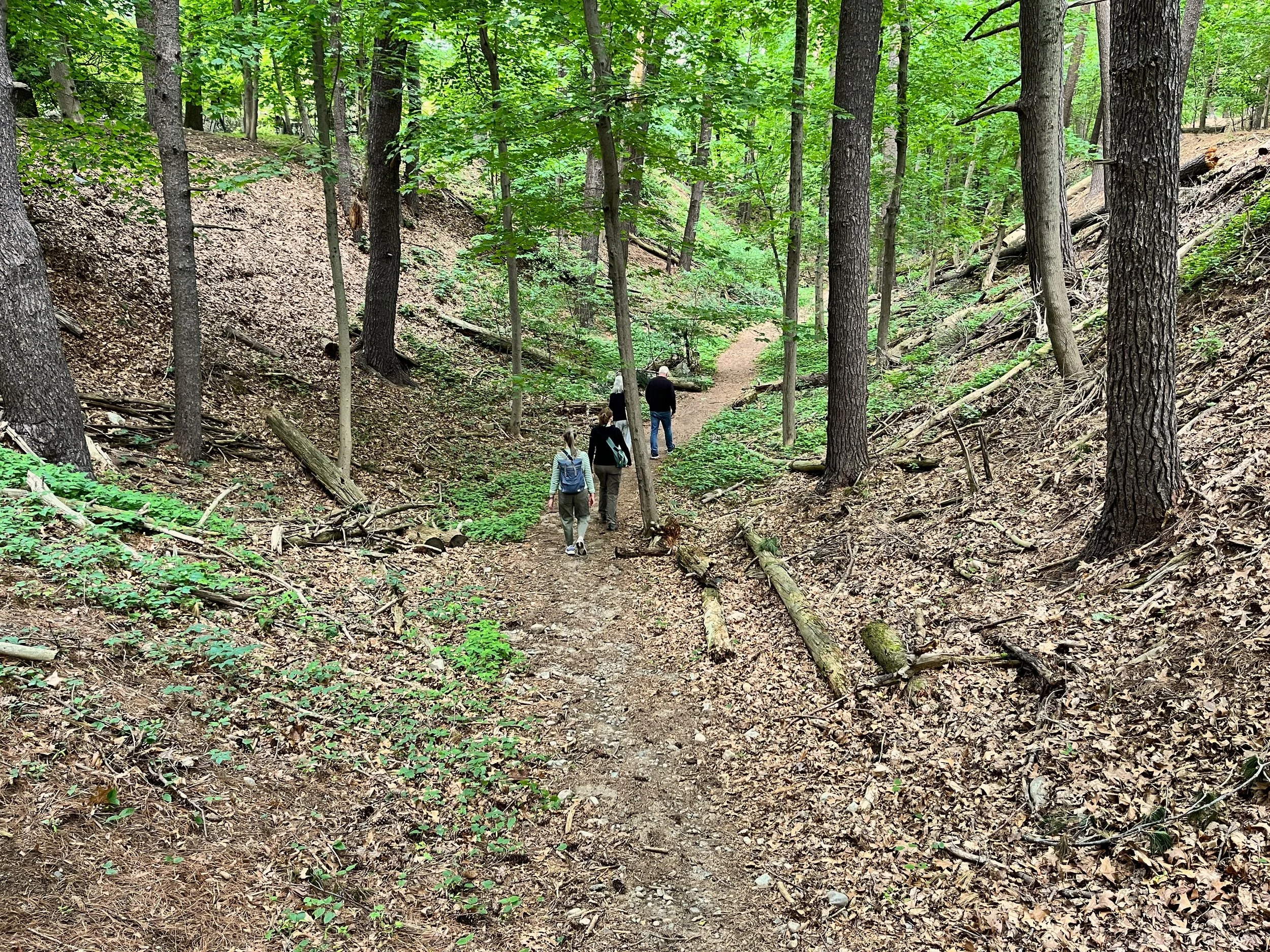
The most rigorous section of the Boundless Boston Trail, which visits some of the highest places within the Greater Boston Area, starts with a ramble through the woods of Cunningham Park to swing past the graffiti-festooned Quincy Quarries Reservation, before tunneling through the trees into the quiet east side of the Bue Hills Reservation. After a gentle walk through the deciduous woods here, things escalated thrillingly with the Skyline Trail to Great Blue Hill and finally, to the Blue Hills Trailside Museum.
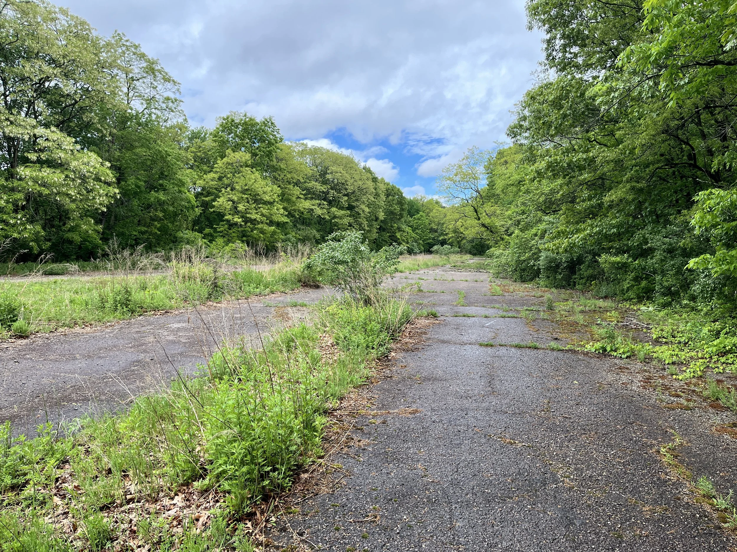
SECTION 4. BLUE HILLS RESERVATION, NEPONSET RIVER RESERVATION, STONY BROOK RESERVATION, BELLEVUE HILLTOP (11.1 MILES)
Begin your exit from the Blue Hills by following an abandoned piece of highway through the Neponset River Reservation before crossing back into Boston’s Hyde Park and exploring the woods and waters of Stony Brook Reservation on the Walking City Trail. Then, proceed to the highest point within Boston and follow the twists and turns of the forthcoming Boston Greenbelt Trail to the banks of the Charles River, where you’ll finish Section 5 of the Boston Boundless Trail at Dedham’s Riverdale Park.
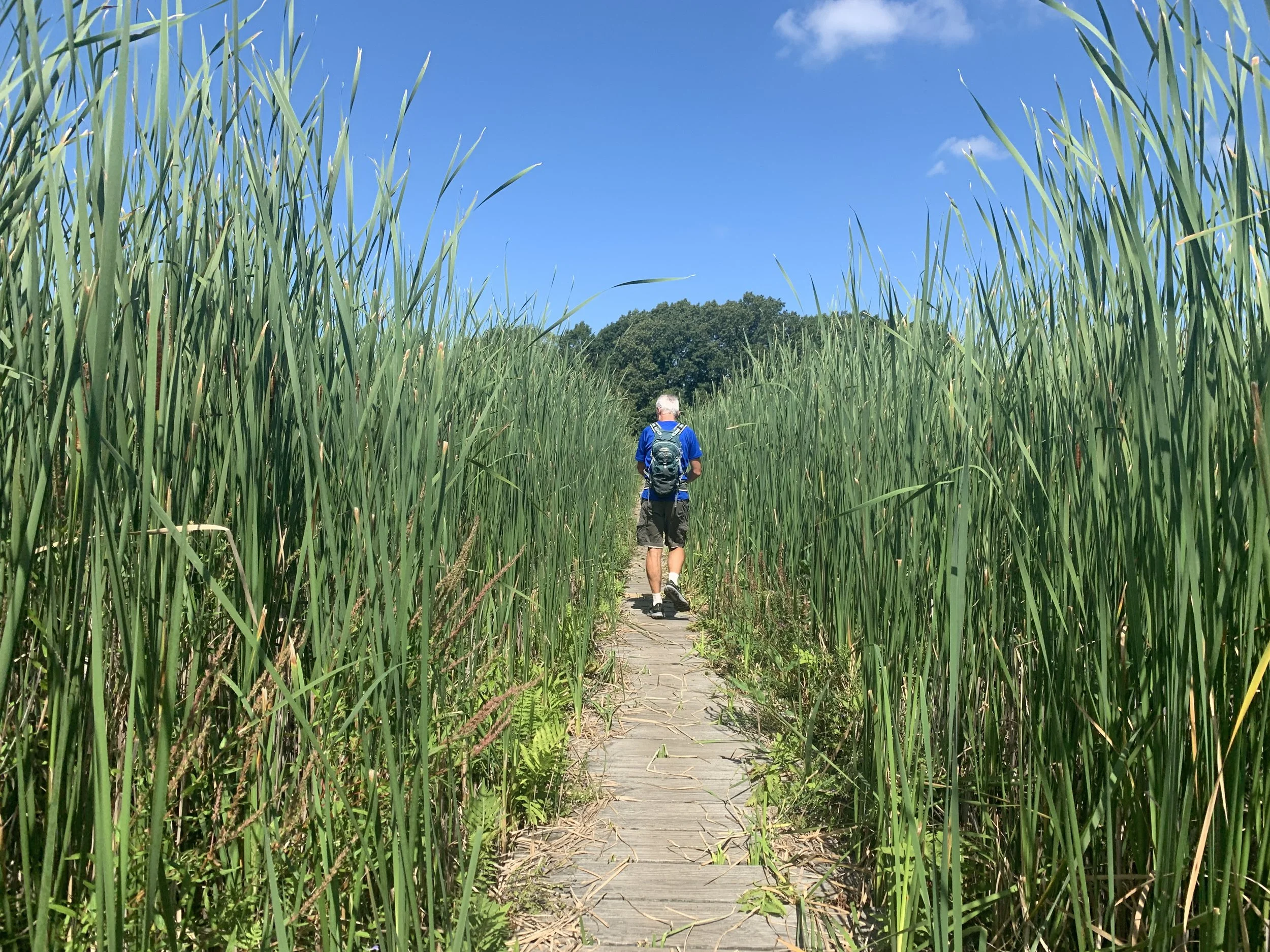
SECTION 5. CUTLER PARK RESERVATION, CHARLES RIVER RESERVATION, NEWTON UPPER FALLS RIVER WALK, HEMLOCK GORGE (8.9 MILES)
Like the prior segment, Section 5 also follows the route of the forthcoming Boston Greenbelt Trail. Experience one of the most immersive marshes in Greater Boston by following the paths and boardwalks of the Blue Heron Trail at Needham’s Cutler Park Reservation. Then, continue onto the paths of the Charles River Reservation to cross into Newton, where the Upper Falls River Walk leads through even more waterside greenery. Watch the scenery go from placid to dramatic at Hemlock Gorge, which you’ll cross on Echo Bridge. From there, follow the river to Waban.
SECTION 6. COCHITUATE AQUEDUCT TRAIL, COLD SPRING PARK, NEWTON CENTRE PLAYGROUND, NEWTON CENTRE GREEN, HEARTBREAK HILL PARK & WOODS, CHANDLER POND (7.1 MILES)
Follow the wooded corridors of lost aqueducts through the hills of Newton to reach the city’s “centre” before climbing one of the most notorious high points in Boston: Heartbreak Hill, the bane of marathoners’ existence. Explore the lesser known waters and woods of the hill before descending into Chestnut Hill for a visit to the unsung oasis of Chandler Pond. A final hill climb marks the segue into Brighton, where Section 6 finishes at Oak Square.
SECTION 7. SQUIBNOCKET PARK, WATERTOWN CAMBRIDGE GREENWAY, FRESH POND, BLACK’S NOOK, BLAIR POND, ALEWIFE BROOK RESERVATION & GREENWAY, SEVEN HILLS PARK (7.8 MILES)
Cross over from the Boston side of the Charles River to Watertown and follow the green banks of Squibnocket Park to the Watertown Cambridge Greenway, which slices through trees and buildings to reach the south shore of Fresh Pond. But reedier, murkier water bodies await north of here; like Alfewife Brook Reservation, whose namesake greenway serves as a connector from Cambridge to Somerville, where Section 7 concudes at Davis Square.
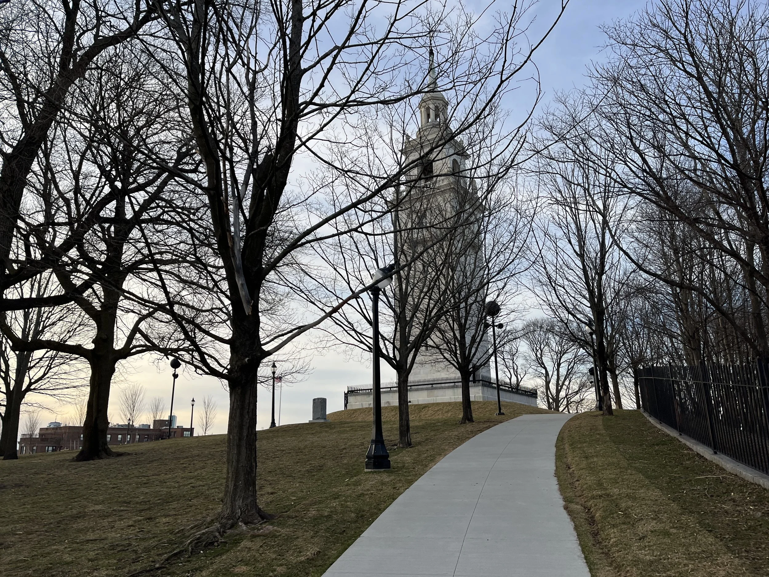
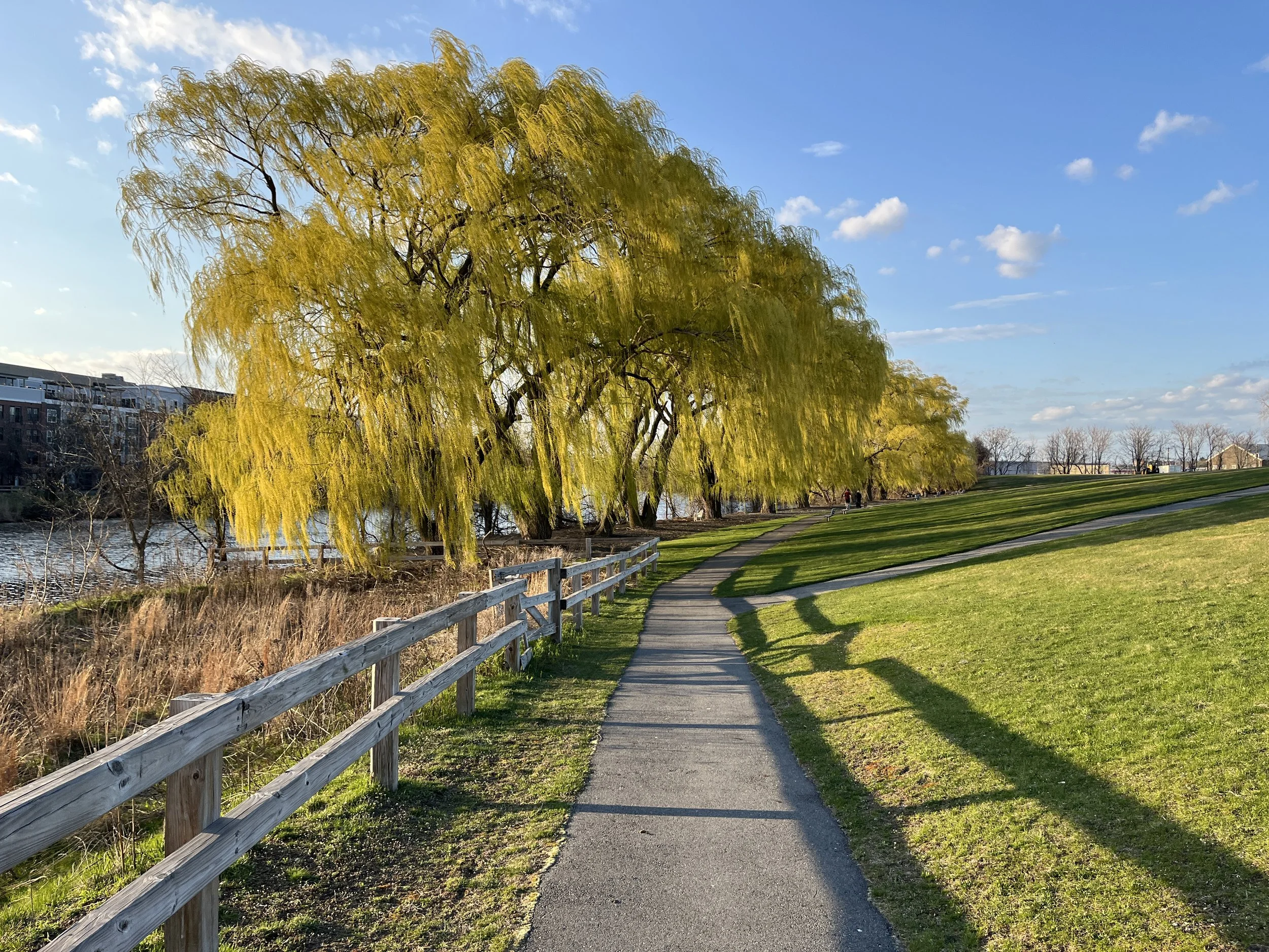
SECTION 8. SOMERVILLE COMMUNITY PATH, PROSPECT HILL PARK, SOUTH STREET FARM, CENTANNI PARK, CAMBRIDGE CROSSING, NORTH POINT PARK, BUNKER HILL MONUMENT (5.8 MILES)
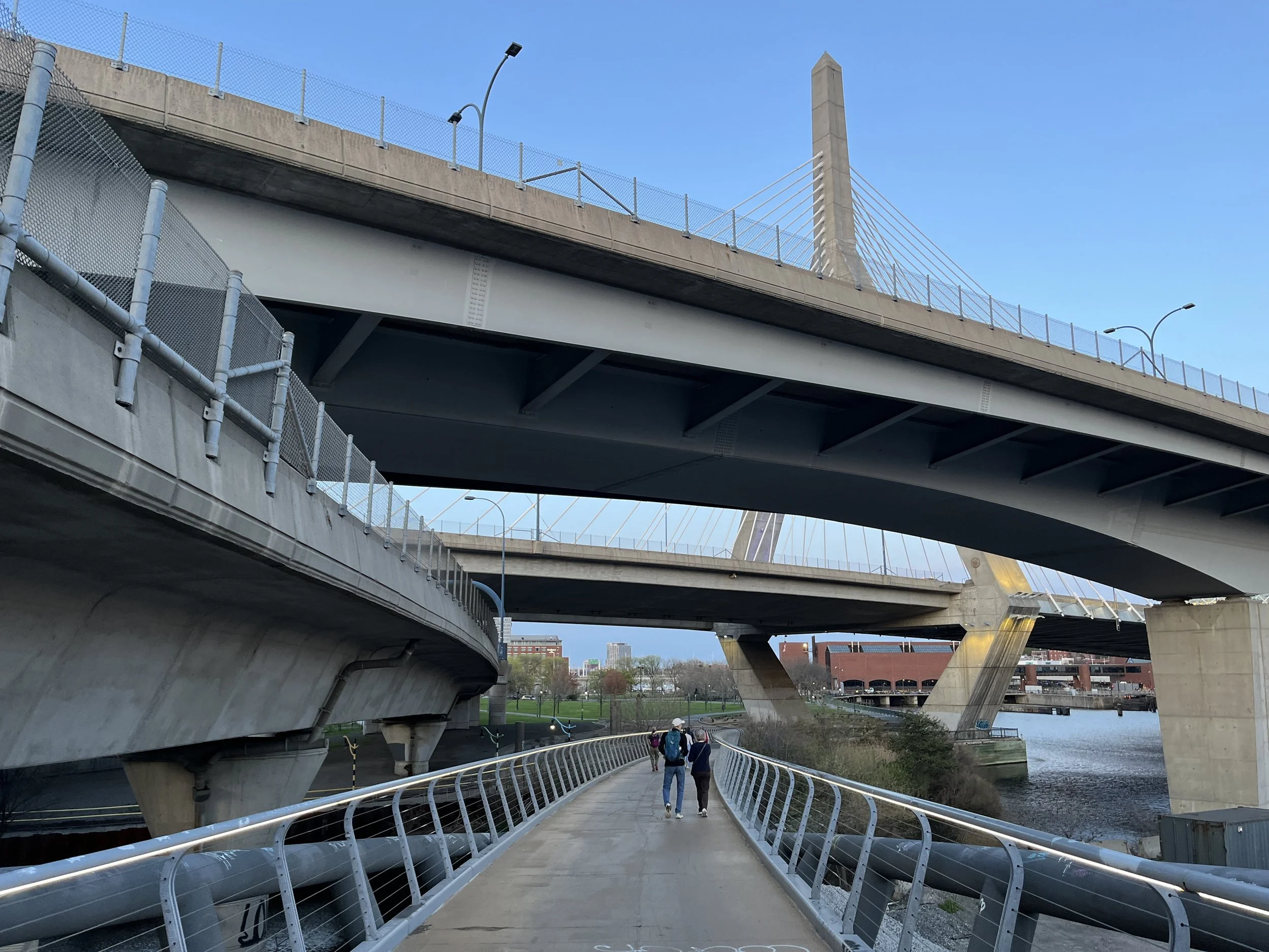
Join the masses on the Somerville Community Path and then follow stairs and streets to the lookout tower at Prospect Hill Park before descending into the nexus of Somerville and Cambridge to navigate a labyrinthine route (with plenty of green nooks) that will eventually deliver you to the banks of the Charles River. More surprises await beneath I-93, before you ascend Bunker Hill to reach its namesake monument; the grand finale of Section 8.
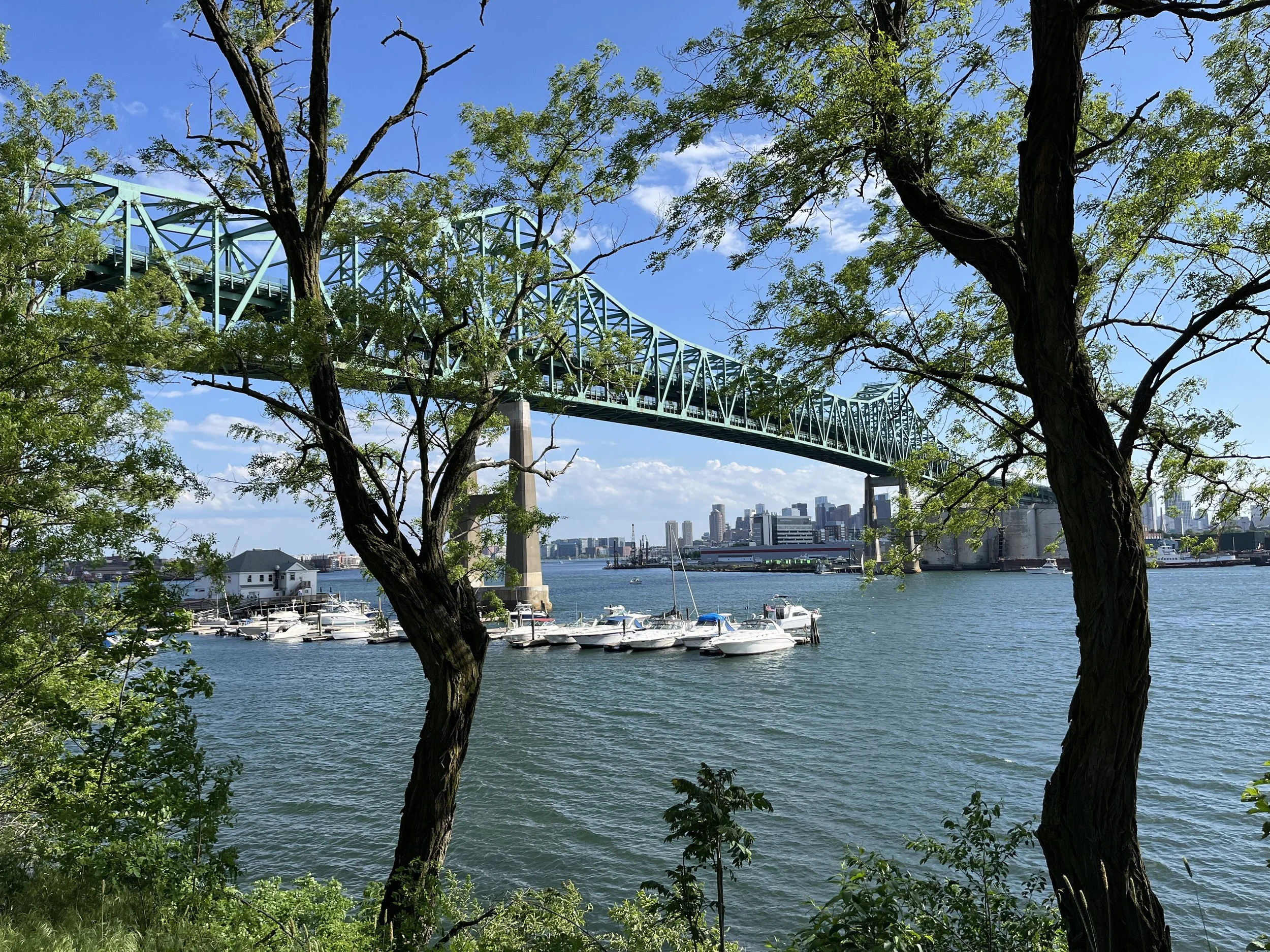
SECTION 9. DOHERTY PLAYGROUND, BOSTON HARBORWALK, MYSTIC RIVER RESERVATION, GATEWAY PARK, VILLAGE LANDING PARK, THE MEADOWS, MARY O’MALLEY STATE PARK, ADMIRAL’S HILL (8.3 MILES)
A winding descent from Bunker Hill leads to the intersection of the Mystic and Malden Rivers, along which you’ll walk winding paths to cross into Everett. Here, a long arc through heavy industrial landscape yields the scenic rewards of Mary O’Malley State Park and a gusty ascent to the top of Admiral’s Hill, from which you’ll cross beneath the Tobin Bridge to finish up at Chelsea Square.
SECTION 10. CHELSEA SQUARE, BELLINGHAM HILL PARK, CHELSEA GREENWAY, EDEN STREET PARK, MALONE PARK, MILL CREEK RIVERWALK, YOUNG’S HILL (5.3 MILES)
Discover the subtly roly-poly nature of Chelsea’s topography by taking the stairs to multiple high points that offer banger views of the Boston skyline. Then, dart behind a shopping plaza to walk alongside a hidden marshland that soon widens into a bonafide blue space. From here, you’ll have to endure the cars and smog of the Revere Beach Parkway, but it’s worth it for the final climb up Young’s Hill and the nearby sands and swells of Revere Beach.
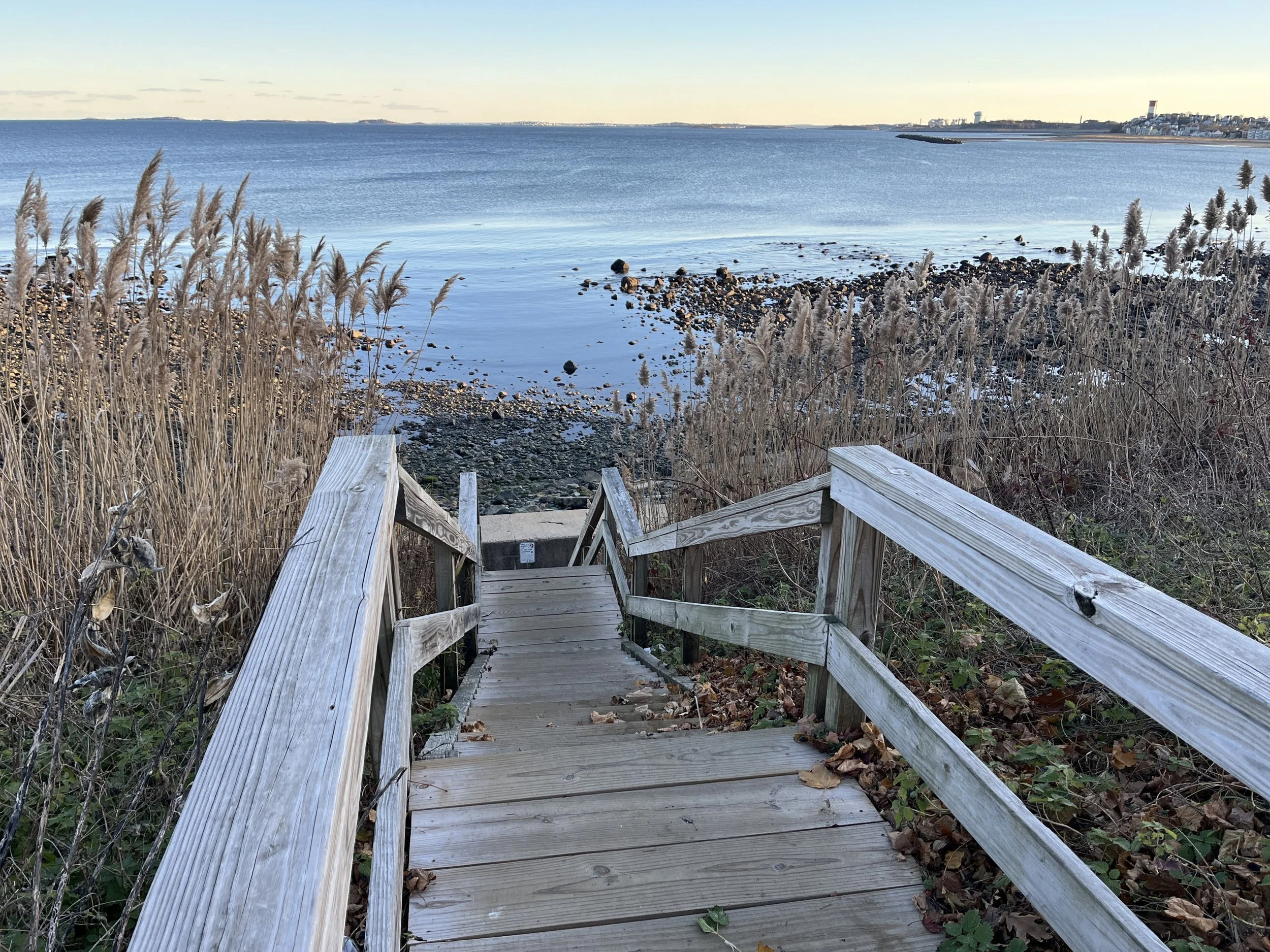
SECTION 11. REVERE BEACH, SHORT BEACH, FORT HEATH PARK, WINTHROP BEACH, BELLE ISLE MARSH (4.7 MILES)
The Town of Winthrop is a literal outlier, connected to the City of Boston by a tiny strip of land that you’ll utilize, on the ocean side and then the marsh side, to visit the final municiality bordering Boston. The salty expanse of Revere Beach and Short Beach will be your gateway to Winthrop, where you’ll take in the overlooks at Fort Heath Park and Winthrop Beach before snaking through the tall grasses of Belle Isle Marsh’s eastern reaches to re-enter Boston for the final push to the end of the Boston Boundless Trail.
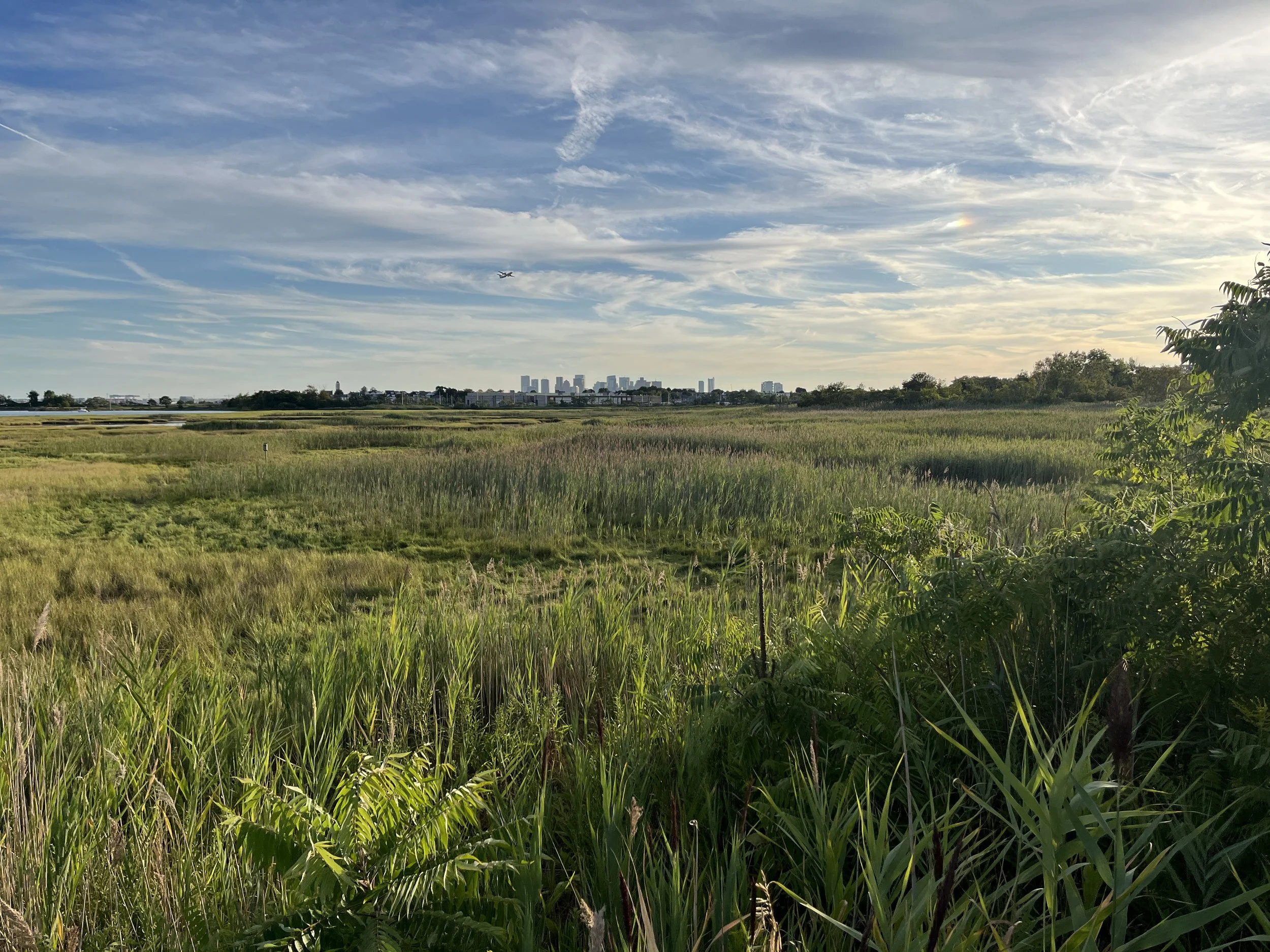
SECTION 12. BELLE ISLE MARSH, ORIENT HEIGHTS, CONSTITUTION BEACH, EAST BOSTON GREENWAY CONNNECTOR, CONDOR STREET URBAN WILD, BOSTON HARBORWALK, LO PRESTI PARK (6.6 MILES)
The final section of the Boston Boundless Trail is an epic tour of East Boston; the only city neighborhood on the opposite side of Boston Harbor. From the boardwalks at Belle Isle Marsh to the Madonna shrine on top of Orient Heights and the sandy arc of Constitution Beach, the wonders of Eastie abound. And when you reach Lewis Mall Wharf, a $2.40 ride across the harbor on an MBTA ferry is all it takes to close the loop in atmospheric fashion!
Ready for a walk? Below you’ll find all of the resources that you need to go for an eye-opening journey on the Boston Boundless Trail; from trail maps to written directions and public transit connections.